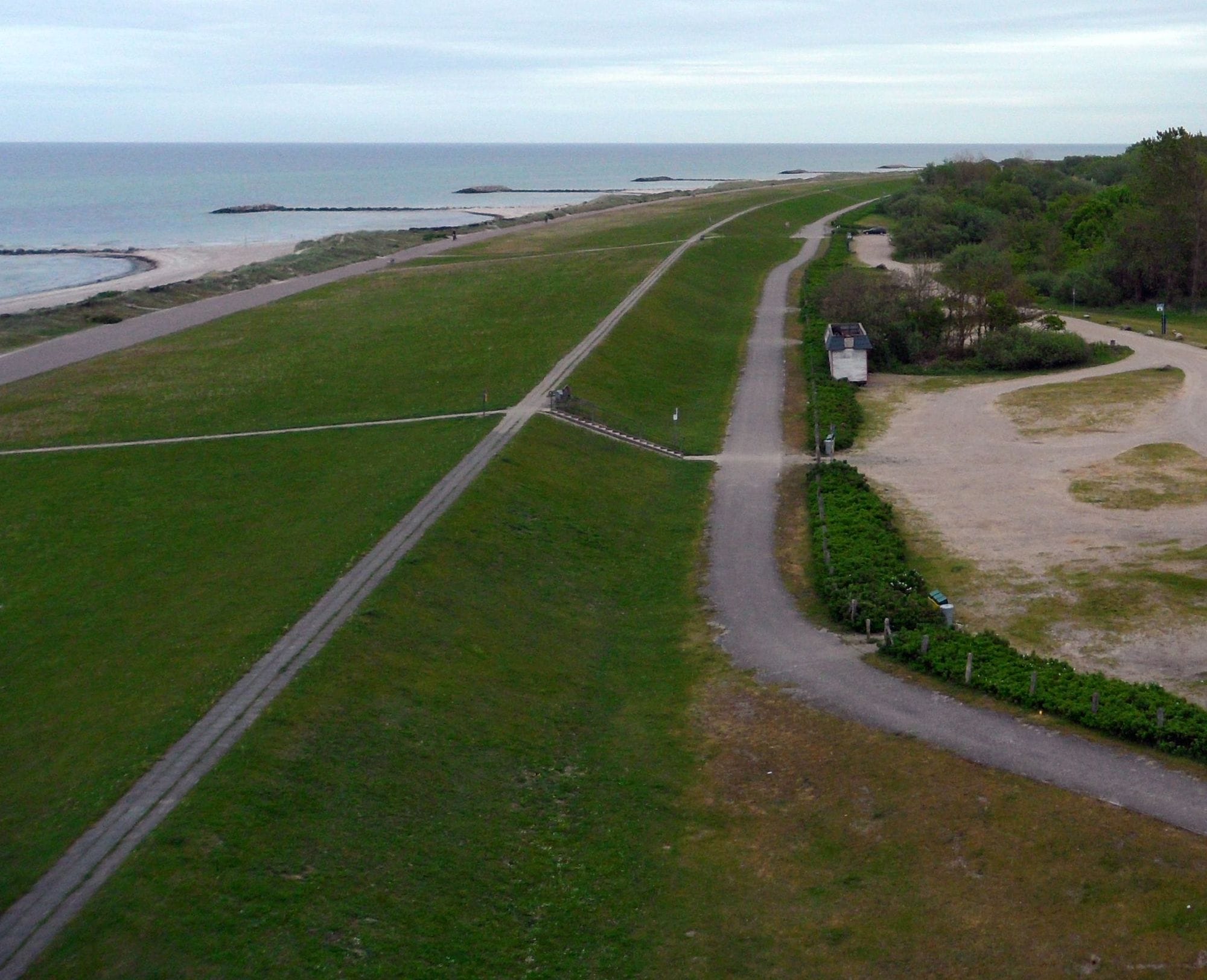
Heidkate is a natural sand beach on the Baltic in Schleswig-Holstein, in the municipality of Wisch, at the northernmost point of the south coast of Kiel Bay. Gemeinde Wisch describes 3.7 km of fine sand in front of the sea dike, divided by rock groynes, and charges no spa tax. A small lighthouse stands behind the dike, and a large car park lies straight behind the launch area.
October to February is the windy stretch. In each of those months more than six days in ten clear 12 knots for three daylight hours or more, with October and January the picks at about two in three. The mean over those rideable hours sits between 16 and 18.5 knots. It is frontal wind, not a sea breeze: the share of windy days barely moves between 8am and 6pm. Summer is lighter, with August the quietest at under half. The record is a 1 km model with three to four years behind each month, so read it as a guide. A January session here can be powered up and bitterly cold at once.
It opens at weekends in the pre-season and every day in the main season, 10am to 6pm.
66% of days clear 12 kt for three daylight hours or more.
In October the wind most often sits at 8 to 11 kt (28% of daylight hours) and is over 12 kt from 11am to 5pm on at least half the days. See both charts in the full report
No weather station near enough to check these figures against.
Take it with you
The full Heidkate report
Seven sections over six pages, built from the same record as this page. A PDF you can read on the plane.
01Hour-by-hour & month-by-month wind02The month's own records03Full stays, schools & kit04Per-launch tide notes05Groynes, sections & the beach rules06Getting there, packing & best months07Sources, and their limits
WindChaser spot reportHeidkateSchleswig-Holstein, Germany · October66% of days clear 12 kt for three daylight hours or more.
When it gets busy
Crowds
The surf school calls it a comparatively quiet beach where everyone finds a spot even in high season, and DLRG lifeguards watch two bathing sections in summer. WindChaser has no crowd count yet.
On the water
What October usually does
Wind directionW or EFree from west-south-west round to east. Side-shore to side-onshore in westerlies and easterlies. In a southerly, spot guides send riders to Laboe.
Wind strength16 to 18.5 ktThe mean over rideable daylight hours, October to February, in the record, a 1 km model with three to four years a month.
When it blowsAll dayFrontal wind, not a sea breeze: the share of windy days barely moves from 8am to 6pm.
Your playground
Launches & safety
Conditions change. Check local rules and conditions before you ride.
Launch
Hazard
Parking
School
Stay
Webcam
Local intel
Getting there & on the ground
Nearest airportHamburg (HAM)About 113 km by road, around 1 hour 30. Kiel’s main station is about 24 km, half an hour.
On the groundOctober to FebruaryThe windiest months in the record. October and January are the picks.
Getting aroundCarBy the B502 and the K33. The car park behind the dike is paid in summer.