Skip to the spot

Hadicurari, Aruba

Oct · 76% rideable

Aruba - Fishermans Huts

What it's actually like

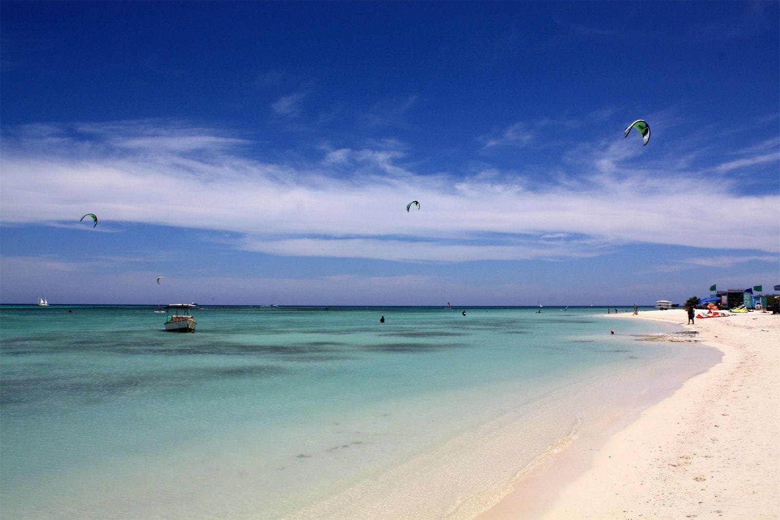
Fisherman’s Huts, also called Hadicurari and now Sarah-Quita Beach, is a rocky strip out past the Marriott on Aruba, with shallow, calm water inside the reef. Aruba’s tourism board calls it the most popular spot on the island to learn and practise windsurfing and kitesurfing. The trade wind blows from the east to east-north-east, straight off the land.

The wind rarely lets up. From December to August more than nine days in ten clear 12 knots for three daylight hours or more, and June reaches 100 per cent in the record. The mean over those rideable hours sits between 17 and 19 knots. It blows all day: the share of windy days barely moves between eight in the morning and six at night. Even October, the quietest month, clears about three days in four. Most of the year the water here is powered up.

Coral starts about 100 metres offshore and riders are asked to keep off it; yellow buoys mark the outer boundary of the riding area and are not to be crossed.

Spotted something out of date? Tell us

Your month

When it's good

12 kt+ for 3+ daylight hours · kite

October · 76%. 23 rideable days in 31, 9.0 hours a day over 12 kt. Come.

Where else it blows in October

Not yet checked against a weather station or an independent model, so treat these figures as a guide.

At a glance

Is it for you?

Skill levelComfortable
WaterMillpond
Wind · OctUsually turns up
Crowds · OctRoom to ride
Local vibeFriendly enough
Water qualityUsually clean
NightlifeLively
CostMid

Geek analysis

October in the record

76% of days clear 12 kt for three daylight hours or more.

In October the wind most often sits at 12 to 15 kt (37% of daylight hours) and is over 12 kt from 8am to 6pm on at least half the days. See both charts in the full report

No weather station near enough to check these figures against.

October on the record

The month's own figures, not the year's average.

Rideable days23 of 31Nine Octobers in the record
Wind, rideable hours16 ktMean over daylight hours at 12 kt+
Air28.3°CMaximum

Take it with you

The full Aruba - Fishermans Huts report

Seven sections over six pages, built from the same record as this page. A PDF you can read on the plane.

01Hour-by-hour & month-by-month wind02The month's own records03Full stays, schools & kit04Per-launch tide notes05Offshore wind, the reef & kiting hours06Getting there, packing & best months07Sources, and their limits

When it gets busy

Crowds

Jun · Medium

Busiest from December to May, the tourist season, according to compiled research rather than a count. Aruba Hi-Winds brings the racers each year; in 2026 it ran from 13 to 18 May.

On the water

What October usually does

October sits outside the best months here. 76% of days clear 12 kt for three daylight hours or more.

Your playground

Launches & safety

Conditions change. Check local rules and conditions before you ride.

  • Launch
  • Hazard
  • Parking
  • School
  • Stay
  • Webcam

Local intel

Getting there & on the ground

Nearest airportAruba (AUA)Queen Beatrix International, about 11 km by road, around 15 minutes.
On the groundDecember to AugustThe windiest months in the record. June is the pick.
Getting aroundCar or busPublic parking and public transport at the beach.

Stay, schools & kit

Who works this beach

© Lysander LoefstokAruba Kitesurfing SchoolSchool$$$MidGoogle MapsKite · WingGroup and private lessons at Fisherman’s Hut, full kit included.
© Jason PearceAruba Active VacationsSchoolGoogle MapsKite · Windsurf · WingLessons at Fisherman’s Huts, with lockers and a rooftop lounge.Website
© Vela Windsurf & KitesurfVela Sports ArubaSchoolGoogle MapsWindsurf · Kite · WingLessons from its centre at Sarah-Quita Beach.
Something wrong?We check before it changes.Suggest a change

Sources

Wind dataOpen-Meteo · ECMWF IFS HRES 9 km · 2017 to 2026Weather data by Open-Meteo.com, licensed under CC BY 4.0. The figures on this page are statistics we counted from that data. Model data: European Centre for Medium-Range Weather Forecasts (ECMWF), CC BY 4.0. Contains modified Copernicus Climate Change Service information 2026 (ERA5). Neither the European Commission nor ECMWF is responsible for any use that may be made of the Copernicus information or data it contains.
Map data© OpenStreetMap contributors · ODbL
PhotosHero, Kites off Fisherman's HutsVlad Podvorny · Wikimedia Commons · CC BY-SA 3.0Fisherman's Huts from above, a kite on the water.Aruba Kitesurfing School · Google Maps · Google Maps Platform termsKiters in the shallows at Fisherman's Huts.Kiteboarding Aruba - Kitesurfing school · Google Maps · Google Maps Platform termsThe beach at Fisherman's Huts.David Spitz · Google Maps · Google Maps Platform termsThe shallow water at Fisherman's Huts.Matt Borr · Google Maps · Google Maps Platform termsSchool, Aruba Kitesurfing SchoolLysander Loefstok · Google Maps · Google Maps Platform termsSchool, Aruba Active VacationsJason Pearce · Google Maps · Google Maps Platform termsSchool, Vela Sports ArubaVela Windsurf & Kitesurf · Google Maps · Google Maps Platform terms